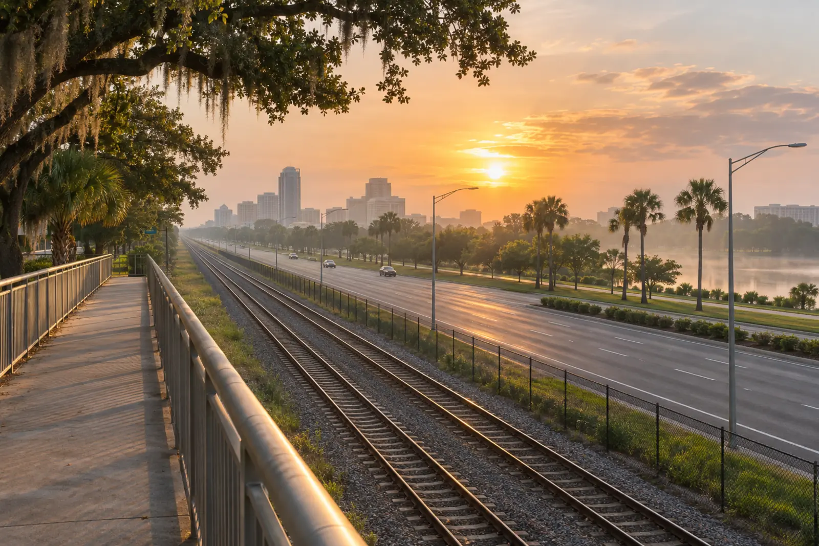
Orlando is a city that runs on cars. The metropolitan area covers roughly 4,000 square miles across Orange, Osceola, Seminole, and Lake counties and was built during the postwar suburban boom under the assumption that everyone owned a vehicle and drove everywhere. That assumption still shapes the road network, the zoning, and the daily rhythms of life here. But the transportation picture has grown meaningfully more complex in recent years, and understanding the full range of options - from SunRail commuter trains to Brightline's high-speed service to Miami - can make a real difference in how you experience life in Central Florida.
Whether you are relocating to Orlando, already living here and looking to spend less time in traffic, or trying to evaluate a commute before accepting a job offer, this guide walks through every serious option available in 2025. The goal is practical honesty: some alternatives to driving are genuinely useful for specific commutes, and some are not worth your time depending on where you live and where you are going. Both are worth knowing before you make decisions about where to rent, where to buy, or how to structure your workday.
Why Orlando Is So Car-Dependent
Most large American cities have at least one dense core that anchors transportation planning. Orlando has several competing employment centers scattered across a large area: Downtown Orlando, the International Drive resort corridor, the theme park district near Lake Buena Vista, Lake Nona's medical city, the Maitland office park belt along I-4, the Sanford and Lake Mary commercial corridors, and Kissimmee's growing employment base to the south. There is no single hub that transit planners can efficiently serve with a single corridor, which is one reason building a useful transit network here is so difficult.
The region also grew explosively during the 1970s through 1990s in a pattern of low-density suburban sprawl. Most residential neighborhoods are separated from commercial areas by design, and sidewalks, when they exist at all, often end abruptly at subdivision boundaries. The result is a metro where driving is not just convenient but, for most trips, the only realistic choice.
This matters when you are choosing where to live. A neighborhood that looks close to your workplace on a map might require getting on I-4, which can turn a 12-mile trip into a 50-minute ordeal on a bad afternoon. Understanding which corridors are worst and at which hours pays dividends before you sign a lease or a mortgage.
Interstate 4: The Road That Defines Orlando Commuting
If you live in or near Orlando, you will eventually develop strong feelings about Interstate 4. The highway runs diagonally through the heart of the metro area, connecting Daytona Beach to the northeast with Tampa to the southwest. Through the Orlando area, it passes through Sanford, Winter Park, downtown Orlando, the theme parks, and Celebration before heading south toward Tampa. Nearly every significant employment cluster in Central Florida sits along or within a few miles of I-4, which means it carries enormous daily traffic volumes with very few viable parallel routes.
Traffic analytics firms including INRIX and TomTom have consistently ranked I-4 through Orlando among the most congested highway corridors in the United States. The downtown stretch is particularly difficult, where multiple interchange ramps stack within a short distance and heavy merge traffic creates a bottleneck that backs up reliably during peak hours. The interchange where I-4 meets the Florida Turnpike near the Disney parks is another chronic problem spot, as is the area surrounding the Universal Orlando Resort and the International Drive interchange.
The I-4 Ultimate Project and Express Lanes
Between roughly 2015 and 2022, the Florida Department of Transportation undertook the I-4 Ultimate Project, a roughly $2.3 billion reconstruction of approximately 21 miles of I-4 through the Orlando core. The project rebuilt the highway, improved interchange ramps, and - most consequentially for daily commuters - added four express lanes in the center median, two in each direction, running from Kirkman Road on the west side to State Road 434 in Altamonte Springs to the east.
These express lanes use dynamic tolling: the price to use them changes in real time based on traffic volume, with the goal of keeping express lane speeds above a minimum threshold. During heavy congestion, toll prices can rise substantially. During off-peak hours, the price drops. The general-purpose lanes on either side remain free of charge. A SunPass transponder is required to use the express lanes, since they have no cash toll booth option. For commuters who use I-4 daily, the express lanes are worth understanding - on a bad afternoon, the premium may be entirely justified by the time saved and the reduction in stress.
The Worst Stretches to Know Before You Drive
The segment between the SR 408 interchange downtown and the SR 528 interchange near the theme parks tends to generate the most severe delays. The area through downtown Orlando where several ramps converge is unforgiving when traffic slows even slightly. The section near Universal Orlando and International Drive is consistently difficult between roughly 3:30 and 7:00 pm on weekdays and on busy weekend afternoons. The Maitland interchange, where SR 414 connects to I-4, is another reliably slow section during morning rush. Checking a live traffic application before getting on I-4 during peak hours is not optional if your time has any value at all.
Orlando's Toll Road Network
One of the most important things to understand about driving in Orlando is that toll roads are not a minor footnote - they are a central part of the functional transportation infrastructure. The Central Florida Expressway Authority (CFX) operates a network of state roads that provide faster, less congested alternatives to I-4 and other free arterials. Knowing which toll roads serve which corridors is essential for building an efficient commute strategy.
The Key Toll Roads and What They Connect
- SR 408 (East-West Expressway): Runs east-west across the Orlando metro, passing south of downtown. It connects the western suburbs to the east side of the city and provides a bypass around downtown I-4 for cross-town trips. Heavy in its own right during peak hours, but still faster than surface streets through the downtown core.
- SR 417 (Central Florida GreeneWay): Forms a beltway around the eastern and southern portions of the metro. It connects near SR 528 at Orlando International Airport in the south to I-4 in the north near Longwood. Lake Nona residents depend on it heavily for access to downtown and the northern suburbs.
- SR 429 (Western Beltway): Serves the western and northwestern quadrant, connecting the theme park area near US 192 in the south to Apopka and Wekiva Springs Road in the north. It is the fastest route between Disney-area employment and the northwest suburbs of Orange County.
- SR 528 (BeachLine Expressway): Runs east-west from I-4 near downtown all the way to Port Canaveral and Cocoa Beach. It passes directly through Orlando International Airport, making it the primary route between the city and OIA as well as the Space Coast.
- Florida's Turnpike: The major north-south toll artery running along the western side of the metro. It connects the northern suburbs through the theme park area and continues down through Kissimmee and into Osceola County to the south, eventually reaching South Florida.
Getting a Transponder: SunPass and E-PASS
If you drive in Orlando regularly, getting an electronic toll transponder before your first week on the road is not optional - it is a practical necessity. Without one, Florida's all-electronic toll system charges you through a program called Toll-By-Plate, which photographs your license plate and bills you by mail with a per-transaction fee added on top of the regular toll. That fee adds up quickly if you use toll roads every day.
SunPass is Florida DOT's statewide transponder, accepted on the Florida Turnpike, all CFX roads, and toll facilities throughout Florida. E-PASS is CFX's own transponder and works on CFX roads throughout Central Florida. The two systems are interoperable - either works on all CFX and Turnpike roads in the Orlando area. SunPass is typically the better choice if you plan to travel elsewhere in Florida, as it is accepted at more facilities statewide. Both can be purchased online or at retailers including Publix, CVS, and Walmart. Verify current pricing and account options at SunPass.com or CFXway.com before purchasing, as these details change over time.
When to Drive: Orlando Traffic Patterns by Time of Day
Orlando's peak traffic hours follow a recognizable weekday pattern with a few local wrinkles that differ from other large metros.
The morning peak runs from roughly 7:00 to 9:00 am, with the worst I-4 congestion typically building between 7:30 and 8:30. The afternoon peak is longer and more severe, stretching from about 4:00 pm to 7:00 pm on weekdays. The 5:00 to 6:30 pm window is the most punishing for anyone who needs to be on I-4 through downtown or near the theme park interchanges.
What sets Orlando apart from most metros is the theme park traffic layer. Tens of thousands of visitors enter and exit the International Drive and US 192 corridors at irregular hours, including mid-morning park arrivals and late-evening departures after park closing. Major events at the Orange County Convention Center - which hosts some of the largest trade shows in the country - generate additional congestion on I-4's western side and on SR 528 connecting to OIA. If you commute near the I-Drive corridor, checking the convention center's event calendar becomes a genuinely useful habit.
Midday traffic on I-4 between roughly 10:00 am and 2:30 pm is manageable by major-city standards. Weekend traffic follows a different pattern, with I-4 often congested westbound toward the parks on Saturday and Sunday mornings and congested eastbound on Sunday afternoons as visitors depart. On busy holiday weekends, weekend I-4 near the theme parks can match or exceed weekday peak levels.
SunRail: Orlando's Commuter Train
SunRail is the Central Florida commuter rail system that has operated since 2014. The line runs roughly north to south through the metro area, from DeLand in Volusia County in the north to the Poinciana Station in Osceola County in the south. For commuters whose homes and workplaces happen to fall near stations, it offers a genuine, stress-free alternative to sitting in stopped traffic on I-4.
The Route and Key Stations
The SunRail line connects more than a dozen stations through the metro core. Key stations from north to south include DeLand, Downtown Sanford, Lake Mary, Longwood, Altamonte Springs, Maitland, Winter Park, the AdventHealth campus (formerly Florida Hospital), Church Street in downtown Orlando, the Orlando Health and Amtrak station, Sand Lake Road, Meadow Woods, and Kissimmee, before continuing south to Poinciana. The line passes directly through the heart of downtown Orlando with multiple stations within walking distance of major employers including AdventHealth, Orlando Health, and the central business district.
The Sand Lake Road station is useful for workers in the Dr. Phillips and International Drive employment corridor, sitting near that intersection south of downtown. The AdventHealth station serves one of the metro's largest hospital systems. For commuters traveling between Volusia County and the Orlando core, the northern extension to DeLand provides an alternative that is considerably less stressful than driving I-4 through downtown twice a day.
Schedule, Limitations, and Fares
SunRail operates weekday service only - no trains run on Saturdays, Sundays, or most holidays. This is a significant limitation that shapes how useful the system is for any given commuter. If your job requires weekend work, SunRail will cover your weekday commute but leave you driving on days when traffic can be just as bad. Service frequency during peak hours has improved since the system opened, but off-peak midday trains are less frequent, which limits flexibility for mid-day appointments or irregular schedules.
Check the current schedule at GoSunRail.com, where you can also find current fare information. Both schedules and pricing are subject to change and any published figure in a third-party source may be out of date. Most SunRail stations have free surface parking lots, which is one of the system's genuine strengths - commuters from the northern suburbs can drive a short distance from their neighborhoods, park for free, and ride the train through the worst of the I-4 congestion. This hybrid drive-to-station approach is how many of SunRail's heaviest users structure their commute and why adoption is strong in the Sanford, Lake Mary, and Longwood corridors.
LYNX Bus Service
LYNX is the regional bus authority serving Orange, Osceola, and Seminole counties. The system operates dozens of fixed routes connecting neighborhoods, employment centers, transit hubs, and SunRail stations. For riders without access to SunRail, LYNX is the primary public transit option.
The honest assessment of LYNX depends heavily on your specific origin and destination. Service is most frequent and reliable along the main corridors - Orange Blossom Trail, Colonial Drive, Orange Avenue, and the routes connecting to downtown Orlando and the LYNX Central Station hub at Pine Street in downtown. Routes serving the theme park employment areas have improved over the years, recognizing that a significant percentage of theme park workers prefer not to drive or do not own cars.
Service in lower-density suburban areas is less frequent, with headways that can reach 60 minutes or more on some routes. Missing a bus in these areas can mean a very long wait, and schedules are built around the assumption that you can adjust your timing to match the bus rather than the other way around. If your workplace is on or near a major LYNX corridor and your schedule is predictable, LYNX can work well. For suburban-to-suburban commutes with no rail alternative, it typically does not provide the reliability most commuters need.
LYNX has also been expanding on-demand service through programs that connect lower-density neighborhoods to fixed routes, addressing the first-and-last-mile problem that limits most bus systems. Check GoLYNX.com for current routes, fares, and on-demand service areas before planning your commute around any specific route.
Brightline: High-Speed Rail to South Florida
In September 2023, Brightline opened its Orlando station at Orlando International Airport, completing a connection from OIA to Miami along Florida's east coast. Brightline operates privately owned intercity passenger rail - not commuter rail - and the Orlando service is aimed primarily at travelers heading to or from South Florida destinations including Fort Lauderdale, Boca Raton, West Palm Beach, Delray Beach, Aventura, and Miami.
For Orlando residents, Brightline's most practical use cases are business travel to Miami, weekend trips to Fort Lauderdale or the Palm Beaches, and airport access for travelers arriving at OIA who want to continue south without renting a car. The trip from OIA to Miami takes approximately three and a half hours depending on the service and number of stops, which is competitive with driving on I-95 or the Turnpike and considerably more comfortable. You can work, eat, or rest on the train in a way that driving for three and a half hours does not permit.
Brightline does not serve destinations within the Orlando metro - it is not a substitute for a local commute. But for the specific use case of regular travel between Orlando and South Florida, it eliminates a 240-plus-mile drive that most Floridians find exhausting, particularly on Sunday afternoons when I-95 through Palm Beach and Broward counties is severely congested. Fares vary significantly based on advance booking lead time and service class. Check Brightline.com for current schedules and pricing, as these details change with demand and seasonal patterns.
Rideshare, Taxis, and Airport Ground Transportation
Uber and Lyft operate extensively throughout the Orlando metro area. Availability is generally excellent in downtown Orlando, the theme park corridor, International Drive, and established suburban neighborhoods. Coverage thins in some newly developed or rural areas on the outer edges of the metro, where wait times can be long and surge pricing less predictable. During major theme park events, convention center peak periods, and holiday weekends, surge pricing can make rideshare considerably more expensive than a typical trip - plan accordingly if you depend on it regularly.
Mears Connect operates a shuttle service between OIA and Walt Disney World Resort, Universal Orlando, and other hotel areas - a major logistical option for the millions of visitors who fly into Orlando without rental cars. For residents, Mears is primarily relevant when hosting out-of-town guests who need resort transportation without a rental vehicle.
Traditional taxi service exists but is significantly less used than rideshare for most Orlando trips. Some hotel corridors and downtown areas have taxi stands, but hailing a cab from a sidewalk is not a realistic expectation outside of the convention center area or major hotel clusters.
Biking and Walking in Orlando
Orlando is not a city where most residents bike or walk to work - the distances and infrastructure simply do not support it across most of the metro. However, genuine pockets of walkability exist, and a growing network of multi-use trails makes recreational cycling and some utility cycling possible for residents near the trail corridors.
The West Orange Trail is a 22-mile paved trail through Apopka and Winter Garden that has become one of the most popular recreational cycling corridors in Central Florida. The Cady Way Trail connects the Winter Park area with Azalea Park east of downtown. The Little Econ Greenway and the Seminole-Wekiva Trail serve the eastern and northern suburbs respectively. These trails work well for weekend recreation and for a small number of commuters who happen to live within practical cycling distance of a trail corridor that aligns with their destination.
For walking, the most practical Orlando neighborhoods are Downtown Orlando, Thornton Park, College Park, Ivanhoe Village, Baldwin Park, and the Winter Park Park Avenue district. These areas have walkable commercial streets, connected sidewalks, and enough density that daily errands and some commutes are achievable without a car. Most of the rest of the metro is not designed for walking as a primary transportation mode, and this is unlikely to change dramatically in the near term given the existing land-use patterns.
Commuting from Key Orlando-Area Communities
Where you live relative to where you work shapes everything in Orlando. Here is a practical summary of commute dynamics from the areas where most residents and newcomers end up living.
Downtown Orlando and Thornton Park
If you work downtown, living downtown eliminates the commute for many workers. Walkability scores are high relative to the rest of the metro. Residents can walk to the SunRail stations at Church Street and Orlando Health/Amtrak, making north-south rail connections straightforward. The tradeoff is higher housing costs and limited parking for those who still need a car for other trips.
Lake Nona
Lake Nona has grown dramatically as a medical and technology employment center in the southeastern metro. Many Lake Nona residents also work locally in the medical city, keeping commute distances short. Access to downtown uses SR 417 or SR 528, typically 25 to 40 minutes depending on the time of day. There is no direct SunRail service to Lake Nona. OIA is nearby, which is a real advantage for frequent business travelers.
Winter Park and Maitland
Winter Park has a SunRail station with direct weekday service to downtown Orlando, making it one of the better-served communities for rail commuters in the metro. The drive to downtown is short in distance but can slow considerably on I-4 during peak hours. The Maitland Boulevard corridor provides an alternative route for jobs in the Maitland office park belt north of downtown. Overall, Winter Park and Maitland residents have more transportation options than most parts of the metro.
Sanford and Lake Mary
These northern Seminole County communities are popular with families seeking more space at lower price points than Orange County. The SunRail stations at both Sanford and Lake Mary make the north I-4 corridor commute significantly more manageable. The drive from Sanford to downtown Orlando can reach 45 to 60 minutes during peak hours on I-4, which is why SunRail adoption is particularly strong here - parking at the station is free, and the train bypasses the worst of the downtown congestion.
Kissimmee and South Osceola County
Kissimmee sits at the junction of the Florida Turnpike and US 192, with SunRail stations serving the northern part of the city. Commuters heading to downtown Orlando can use SunRail from the Kissimmee area stations rather than fighting I-4 northbound in the morning. Theme park workers in Lake Buena Vista are close enough to use the 417 and Turnpike interchange without going near downtown. Anything north of downtown on I-4 is a long haul from Osceola County and generally not practical as a daily drive.
Windermere and Dr. Phillips
These western Orange County communities sit close to the theme parks and the SR 429 and I-4 interchange. Commutes to theme park employment can be very short. Commutes to downtown Orlando use I-4 eastbound, which is manageable in the morning peak but can be difficult in the afternoon. There is no SunRail service in this corridor, making the car and toll road combination the primary option for most residents here.
Practical Tips for Navigating Orlando Traffic
- Get a SunPass transponder before you need one. Setting it up in advance means you can use express lanes and all toll roads without mail bills and per-transaction fees. Do not wait until your first week of commuting to sort this out.
- Use live traffic navigation every single time you get on I-4. Google Maps and Waze both have strong real-time traffic data for the Orlando area. Route suggestions change meaningfully based on current conditions, and the alternate routes suggested are often genuine time savers rather than just technically shorter paths.
- Consider flexible start and end times if your employer allows it. Shifting your workday to start at 7:00 am instead of 8:30 am, or to end at 3:30 pm instead of 5:00 pm, can dramatically change the I-4 experience. Even a 30-minute offset can be the difference between a smooth drive and a parking lot.
- Check the Orange County Convention Center calendar. Large conventions fill I-4 and the SR 528 corridor with rental cars and shuttle buses that add meaningfully to congestion. Knowing which weeks are heavy lets you plan alternatives in advance rather than being surprised mid-week.
- Test your commute at actual peak hours before committing to a neighborhood. If you are choosing between areas, do a test drive at 8:00 am on a Tuesday from the candidate neighborhoods to your workplace. A Sunday afternoon is not a reliable proxy - do not make a housing decision based on how easy the roads felt on a weekend.
- If your commute follows the north-south I-4 corridor, seriously evaluate SunRail. The park-and-ride lots are free, the train bypasses the worst congestion, and arriving at work without the cumulative stress of rush-hour driving has real value that is easy to underestimate until you experience it for a few weeks.
Frequently Asked Questions
Does Orlando have good public transportation?
Relative to the size of the metro area, Orlando's public transportation is limited but has improved meaningfully with the addition of SunRail and enhanced LYNX routes. SunRail works well for commuters whose home and workplace are near its stations on the north-south corridor. LYNX covers main arterials adequately but struggles with the frequency needed for suburban-to-suburban trips. For most Orlando residents, a car remains essential, but transit is a realistic option for specific corridors and commute patterns - it depends almost entirely on where you live relative to the lines that exist.
How bad is traffic on I-4 in Orlando?
Very bad during peak hours. The stretch through downtown Orlando and past the theme park interchanges has consistently ranked among the worst traffic corridors in the United States by traffic analytics firms including INRIX and TomTom. During the afternoon peak from roughly 4:30 to 6:30 pm, speeds well below 20 miles per hour on I-4 through downtown are common. Using the express lanes, adjusting your work schedule, or taking SunRail are the main coping strategies for people who must use this corridor daily.
Can you live in Orlando without a car?
It is possible in a small number of neighborhoods - primarily Downtown Orlando and parts of Winter Park - where walkability and transit access are meaningful. Outside those areas, living car-free in Orlando is genuinely difficult compared to denser cities. The distances between residential and commercial areas, gaps in the bus network, and the design of most suburban areas make it impractical for the majority of residents. If living car-free is a priority, focus your housing search on downtown Orlando or the College Park and Ivanhoe areas, where daily errands and transit access are the most realistic.
What toll transponder do I need for driving in Orlando?
Either SunPass or E-PASS works on all major toll roads in the Orlando area, including the CFX roads (SR 408, 417, 429, 528, 414) and the Florida Turnpike. SunPass is the better choice for drivers who also travel to other parts of Florida, as it is accepted at toll facilities statewide. Without any transponder, Florida's Toll-By-Plate system bills you by mail with a per-transaction fee added on top of the base toll. Verify current transponder pricing and reload options at SunPass.com or CFXway.com before purchasing.
How long does the commute from Kissimmee to downtown Orlando take?
By car on I-4 or the Florida Turnpike, the drive from downtown Kissimmee to downtown Orlando typically takes 30 to 45 minutes in normal conditions and can reach 60 minutes or more during heavy peak-hour traffic. SunRail offers a less stressful alternative for commuters near the Kissimmee area stations, with scheduled travel times to downtown Orlando stations in the 30 to 40-minute range depending on which stations are involved. Check GoSunRail.com for current schedules and compare the departure times to your actual work hours before relying on it.
What is the least congested time to drive through downtown Orlando on I-4?
The windows with reliably lighter traffic are roughly 10:00 am to 2:30 pm on weekdays, before 6:30 am in the morning, and after 7:30 pm in the evening. Saturday mornings before 9:00 am are typically manageable, but holiday Sundays are among the worst days of the year on I-4 in both directions as theme park visitors depart at once. Avoiding I-4 entirely on New Year's weekend, Thanksgiving Sunday, and Christmas week is the safest strategy when your plans allow any flexibility in timing.
For real-time road conditions, lane closures, and construction alerts across the Central Florida highway network, the Florida Department of Transportation's FL511 service at fl511.com provides corridor-by-corridor updates by county - it is worth bookmarking before your first week on Orlando roads.
Have more questions about life in Orlando - neighborhoods, local services, or what to expect when you arrive? The Orlando Headlines team covers local developments across the metro as they happen. Reach out through our contact page and we will do our best to point you in the right direction.